LOCATION AND ACCESS
La Calera is a hamlet of the village of Alía. It can be reached by a local road about 10 km north of the centre of Alía.
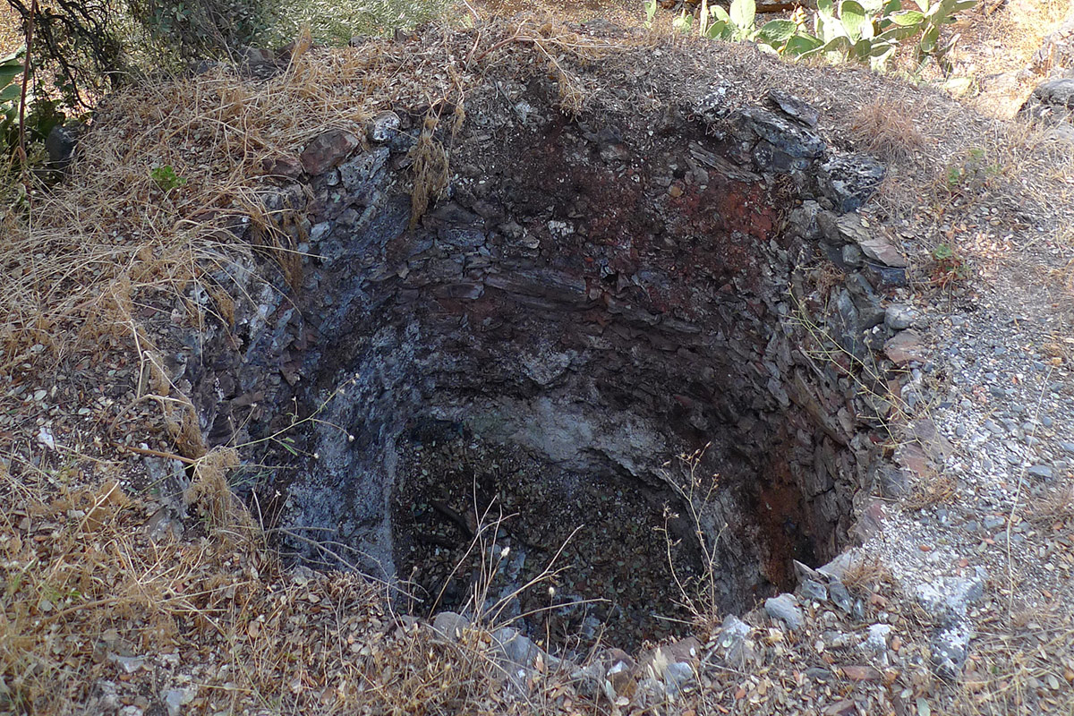
Some six kilns are still standing in various states of conservation. The ovens and the limestone quarries can be seen. The kilns are located in two groups:
The first of them in the vicinity of the village, taking the road to Navalvillar de Ibor. It is made up of a group of three kilns, one of which is practically destroyed, and a fourth which is separate from the first three.
The second group of kilns, and the most distant, is also in relatively good condition and, as in the previous group, the quarries for extracting limestone rocks are located nearby.
To complete your knowledge, we recommend a visit to the La Calera Kilns Interpretation Centre, located in the village centre, which shows the process of extracting limestone rocks in the quarries and the subsequent production of lime in the kilns.
ATTRACTIONS OF THE VISIT
The origins of this small village are due to the quarries and lime kilns in the surrounding area, which were used at different times, above all to supply lime to the nearby Monastery of Guadalupe during its construction in the 14th century. Next to the kilns can be seen the quarries from which the limestone rocks were extracted. The quarrying face can be seen, which is about 3 m high and 25 m long, with the largest area of these rocks covering almost 100 m2.
The dimensions of the kilns are almost uniform, with a diameter of 2.5 m and a height of 3-3.5 m. The limestone (calcium carbonate, CaCO3) was placed on a bed of holm oak wood. They were lit and subjected to calcination, at a temperature of 700-900ºC for three days, in order to convert the calcium carbonate in the limestone into quick lime (calcium oxide, CaO). The quicklime is slaked by adding water and a white paste is obtained which is used to whitewash walls and as a binding element, mixed with sand, to build stone or brick walls.
GEOLOGICAL INTERPRETATION