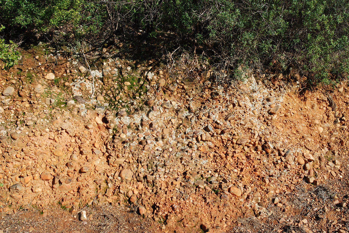
The rañas are extensive plains of sedimentary origin that take the form of a plateau owing to the great depth of the current river network. Its materials are conglomerates that are not cemented or hardly so and are arranged as huge alluvial fans or tongue-shaped outflows.
If we observe a cross-section (for example in the trenches along the road) we will see that these conglomerates are formed of boulders or blocks, generally of quartzite, that are very rounded in shape and included within a clayey-sandy reddish-yellow matrix. This layer is several metres or even up to ten metres thick and is always arranged in a discordant manner (not parallel to those previously deposited) on other older clayey sediments, or on the shales and quartzites of the Palaeozoic basement.
They are fluvio-torrential in origin. In other words they are the result of the transport of materials that were violently dragged away by unchannelled waters and deposited in the vicinity of the quartzite sierras from which they originate. This occurred at the end of the Pliocene period some three million years ago owing to the tectonic movements of the last phase of Alpine orogeny and to the climate (with sharp changes in temperature and violent storms) that eroded the highest rocks after these tectonic movements.
The rounded materials of the rañas come from the hard quartzites, the fragmentation of which generates boulders and blocks. However, the crumbly shales (lutites) break down to form the clayey-sandy matrix.
The rañas represent an important image of the most recent geological history of Las Villuercas. They emphasise the importance of the erosive and sedimentary phenomena that modelled the relief at the end of the Tertiary. Sufficient energy was used to break up and transport billions of cubic metres of materials and deposit them on the foothills of this mountainous massif to leave as a result the magnificent valleys that shape it.