LOCATION AND ACCESS
When entering the municipal district of Villar del Pedroso from El Puente del Arzobispo, take a road on the right immediately after passing the bridge of the same name over the River Tajo; follow the path nearest the watercourse and you will finally reach the defile after a route of some 2 km. From its beginning at an old mill to its joining the Tajo the defile is some 750 m long.
ATTRACTIONS OF THE VISIT
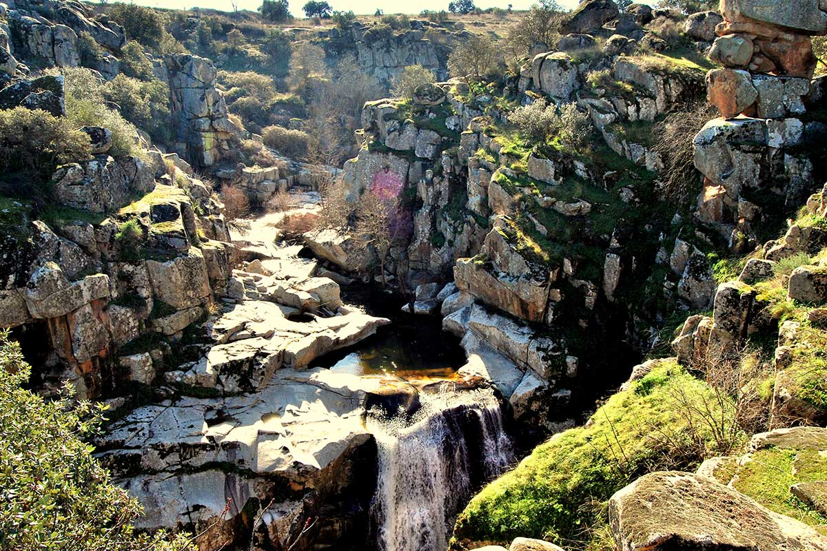
We can observe the curious erosive forms that are the result of the chemical and mechanical meteorisation of the granite rocks (rounded blocks, “mushroom stones” and “knight stones“; and the various fracture planes (diaclases) that have determined the formation of blocks of different sizes within the massive granite rocks and in the aplite dikes.
The encasing of the Arroyo del Pedroso within these rocks is spectacular and has led to the formation of rapids, waterfalls, and “potholes” or pilancones. When the water of the Arroyo is running high it is not possible to cross to the other bank; the roar of the water falling into the deep canyon is awe-inspiring.
The excursion can be completed with a visit in the vicinity to the ruins of several old mills and the impressive fortress of Castros, its walls, the columns of the bridge over the River Tajo and the surrounding houses; and the Muslim fortress which was built in the 10th century adjacent to the nearby Islamic city of Vascos so as to defend the middle frontier of the Tajo.
In a plaza of Villar del Pedroso we can also admire several zoomorphic sculptures (“verracos”) executed by the Vettonian people of the Iron Age, together with numerous Roman inscriptions of great archaeological interest.
GEOLOGICAL INTERPRETATION